
Solutions
Urban Planning
For urban planners and economic development agencies. Create compelling 3D visualizations of street redesigns to engage stakeholders and build consensus for transformative projects.
Learn moreEducation
For students and educators from Pre-K to Post-Doc. Empower learners to understand urban design principles through hands-on 3D modeling and visualization of street environments.
Learn moreTransportation and Land Use Advocacy
For volunteers and staff from neighborhood associations to global NGOs. Create powerful visual stories that communicate your vision for safer, more sustainable streets.
Learn moreProduct Features
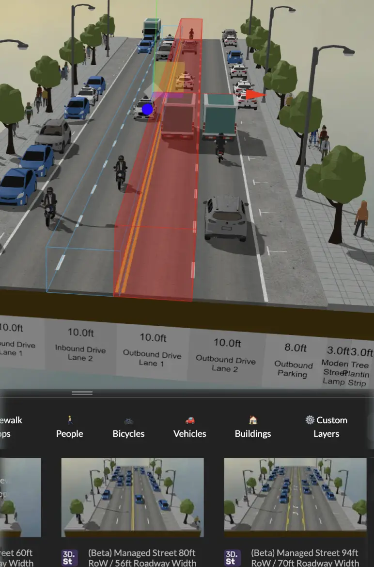
Instant Street Design
Drag-and-drop to place linear 3D streets and 90º intersections with modifiable components. Start with existing templates or create your own, then modify, duplicate or delete segments. Create before and after conditions with procedurally generated elements to illustrate the impact of changes.
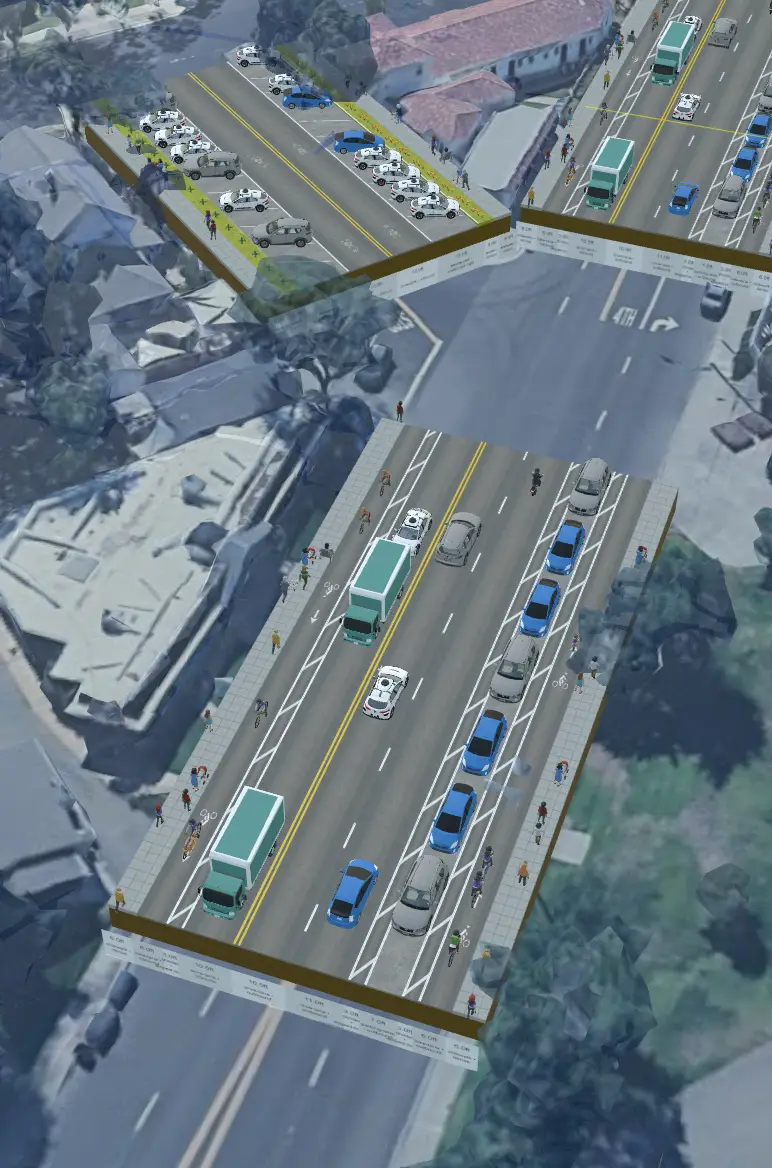
Combine with 3D Maps
Blend 3D street models with 3D map tiles to visualize projects in real world context. Choose from a variety of map styles and providers to best illustrate your project. Inform street design to match actual conditions by making realtime changes to street layout and elements with the map layer serving as a reference.
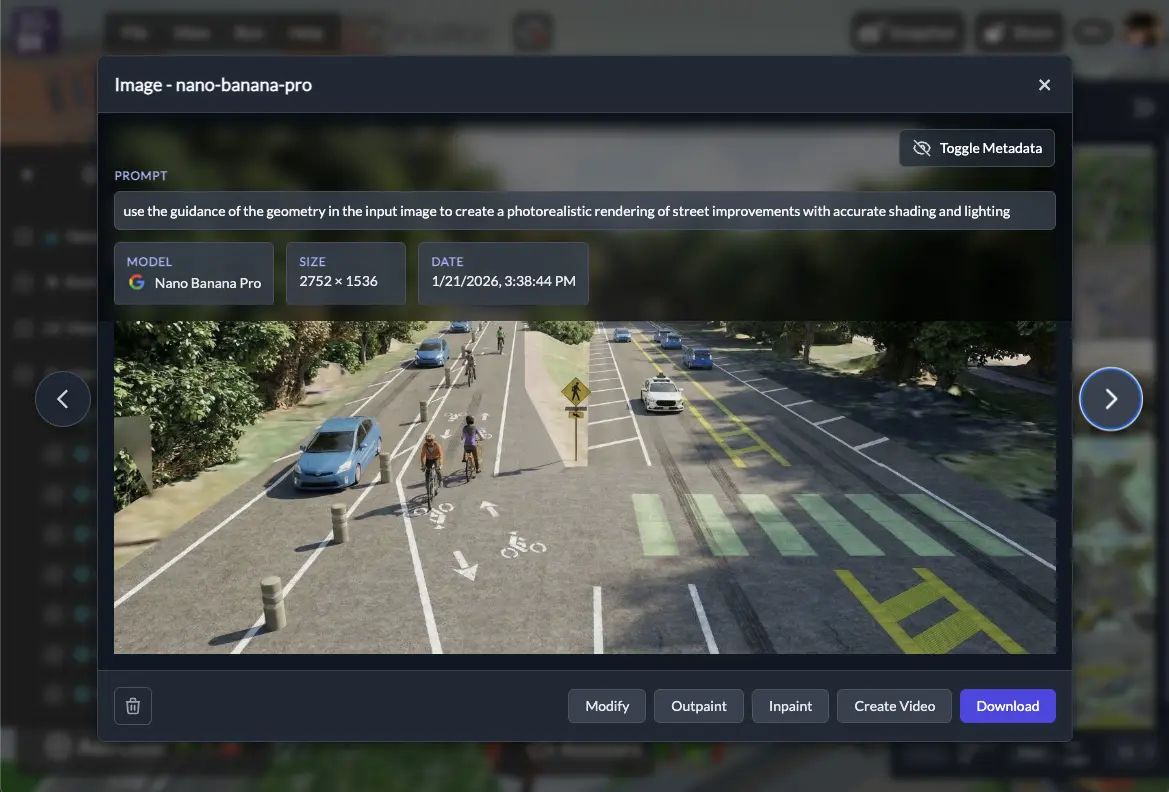
AI Rendering
Transform your 3D scenes into photorealistic images and short videos with frontier AI models from Google, Black Forest Labs, ByteDance, and more. Render directly from the Editor's snapshot button or use the dedicated AI Generator app to modify images, create from prompts, and animate. Pro subscribers get monthly AI generation tokens, with all renders synced to a Cloud Gallery accessible across devices.
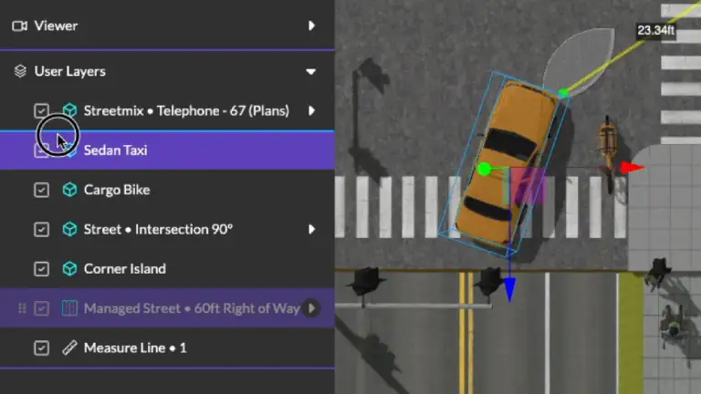
Batteries Included
Kickstart your original designs with 3DStreet's built-in library of over 200 unique and accurately scaled urban 3D models such as pedestrians, vehicles, buildings, street objects, and more. Automated smart Layers accelerate the creation of street elements by combining pre-made segments for sidewalks, parking stalls, bike lanes, railways, BRT corridors, and more.

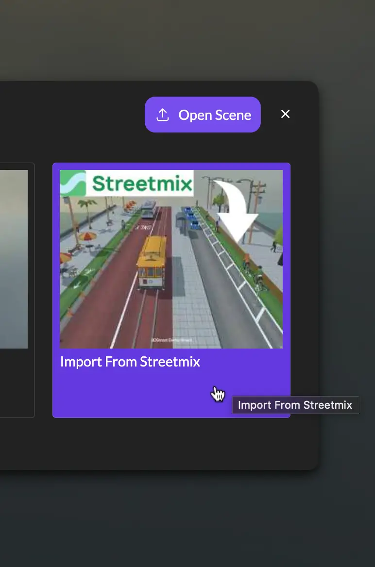
One-Click Import
Convert Streetmix and StreetPlan typical cross-sections from 2D to 3D with automatic procedural extrusion. From either app you can click to Export to 3DStreet, or you can copy/paste the cross-section URL into the 3DStreet Editor. The cross-section is converted into a linear street model complete with street surfaces, relative curb elevations, and lane striping.
Export for AR, VR and 3D post-processing
Export 3DStreet scenes to glTF, JSON, and other formats for use in Augmented Reality, advanced 3D rendering, and detailed design reference. Our "AR Ready" export option creates an optimized GLB file to ensure compatibility with popular AR platforms like Adobe Aero and InCitu. Exported models can also be used with professional rendering tools such as Blender for photorealistic 3D rendering, or CAD tools to inform detailed designs.

Share and Remix
Create from any desktop browser, share with colleagues, and remix with the community. Generate images and record animations for use in social media and public materials. Share the actual 3DStreet scene link with your colleagues for them to remix and modify the scene. Browse other Community scenes for inspiration and remixing parts to include in your own projects.

More Than Transportation
Construction Planning
Create detailed construction site plans with 3D visualization of traffic flow and temporary street modifications to minimize project disruption.
Event Planning
Visualize street closures, route diversions, and temporary installations for festivals, parades, and public gatherings with photorealistic 3D renderings.
Public Space Activation
Transform underutilized streets into vibrant community spaces with interactive 3D mockups showing parklets, outdoor dining, public art, and recreational areas.
Competitive Proposals
Stand out in RFPs with immersive 3D visualizations that clearly demonstrate your design's advantages over traditional 2D plans and elevations.
Property Development
Showcase potential development projects and their integration with existing streetscapes, highlighting improved pedestrian accessibility and enhanced neighborhood connectivity.
Landscape Architecture
Design complete streetscapes with integrated green infrastructure, showing realistic tree canopies, bioswales, and permeable surfaces to visualize both aesthetic and functional benefits.
Latest blog posts

 Kieran Farr
Product Update: Custom Asset Uploads, Video-to-Splat, and Bollard Buddy for iOS

Kieran Farr
Product Update: Editor Panel Redesign
Kieran Farr
Product Update: Layer Reordering, AI Model Upgrades, and Faster Loading

Kieran Farr
Product Update: AI Image and Video Generator, Cloud Gallery, and More
USED BY
University of Oregon


World Bank Group
City of Silverton, Oregon